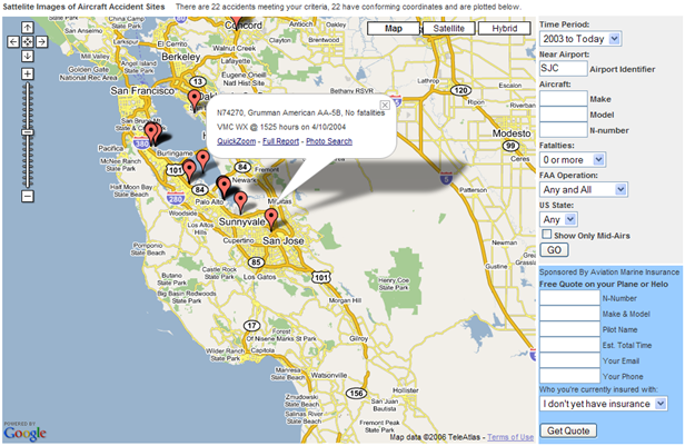
For a while now, the FAA and NTSB have been recording the GPS coordinates of aviation accidents. So it was probably just a matter of time before someone made a mashup using the data, right?
Wait no longer. The folks at Aviation Marine Insurance have done just that with their AVCRASH map.
You can limit the search by year, location, aircraft make/model and N number, fatalities, and so on. Cool stuff. The screenshot above shows all 22 accidents in the vicinity of the San Jose airport from 2003 until today.
Posted by jzawodn at January 03, 2007 07:46 PM | edit
Nice find Jeremy. I submitted AVCRASH to Digg as it's worth Diggin'
http://www.digg.com/tech_news/AVCRASH_Plane_Crashes_on_Google_Maps
Well that's smashing.
It is indeed very helpful information. It will be very useful to all those who spend half of their life traveling.
Also for those people who have never traveled or travel very rarely.Now you can get all the information you require to fly safely.
Your blog is getting too popular.
It looks like their entire site crashed.
Bad Request (Invalid Hostname)
Well, it WAS useful, until it hit Digg. Now it's gone.
That's quite interesting.
I don't get one thing though, how does this make us more safe? Dane White mentions that this is the kind of information you need to fly "safely". Why is that?
Unless we assume that it's rather impossible for a plane to crash twice in the same route so if there's already been one accident you should be fine :P
Yes, the FAA and NTSB are only involved in US-based accidents (unless requestd, I imagine).
Legionnaire - Funny you should mention that. A year ago, we interviewed a celebrity photographer that had been involved in a helicopter crash into Lake Havasu on a photo shoot. He claimed that he had calls from several pilots that wanted him to tag along on the theory that nobody's luck could be bad enough to crash twice!

