
Last Saturday we headed into Yosemite National Park for some hiking. Given that Summer is basically over and the kids are all back in school, we were a bit surprised at how many folks were in the park. But the weather was nearly perfect (sunny and mid-50s to low-60s), so we could hardly blame anyone for spending the day outdoors.
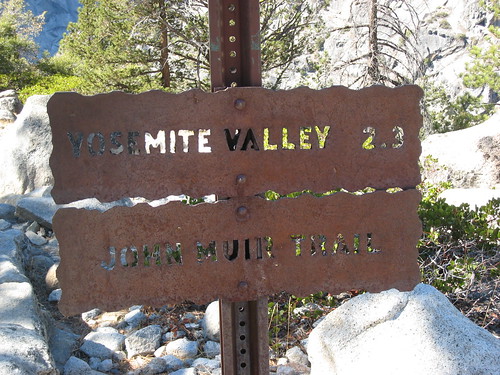
For the ascent, we took the John Muir Trail from the Happy Isles valley floor up to Nevada Falls and Vernal Falls.
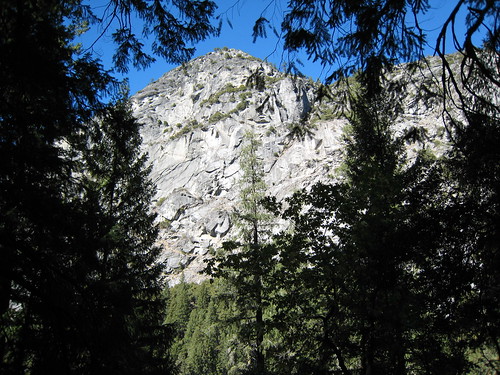
The initial part of the trail was probably the most challenging. The John Muir Trail starts out fairly steep (compared to later parts of the climb), so it was hard to get adjusted. I started with the pack on my back and didn't get much of a chance to warm up before we were right into the climb.
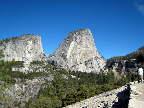
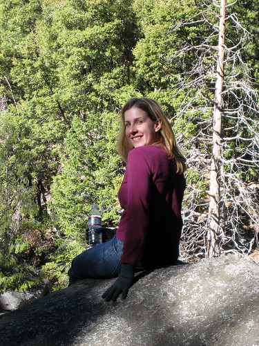
On the plus side, the scenery was amazing pretty quickly. And the relatively low temperature made it comfortable. After a couple hours of climbing, eating, and resting, the trail started to shallow out a bit and we were within view of the Nevada Falls.
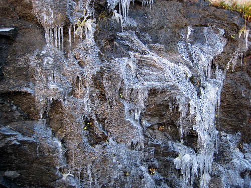
On the way there, we had to cross some wet and icy areas. Even the rock wall on one side of the trail was covered in ice.
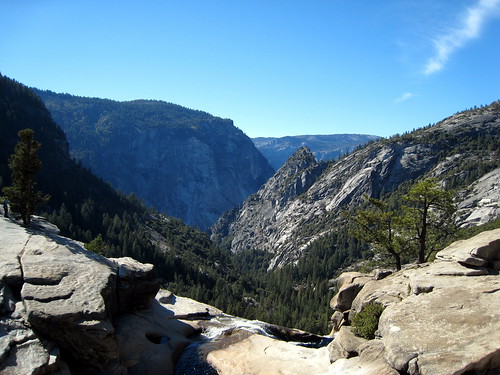
But before too long, we made it to the top and got to enjoy the view across and down into the valley.
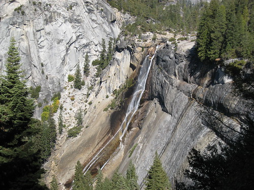
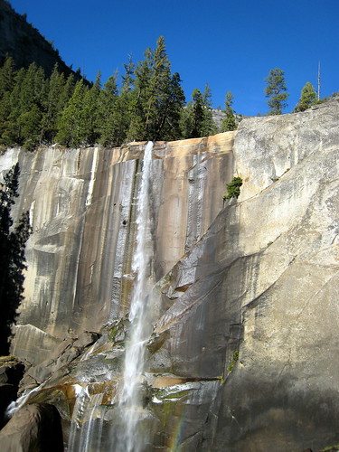
From there we made a quick restroom break and continued on via the Mist Trail and a slightly more leisurely hike down to Vernal Falls, stopping to take in the sights now and then.
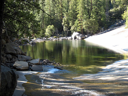
Just before reaching the falls, we came upon the lake where the water collects before going over the falls. Had it been hot outside, I'd have considered dipping a toe or two in the water. Instead, I opted to take a few photos and continue on.
From there we continued the descent down the rock "stairs" and were treated to more views of the falls.
The hike took us about 4.5 hours in total (I think) and was a bit over 8 miles (I think). I was a bit sore the next day, but it proved to be nothing compared to the horseback riding.
I'd love to do this hike again when the falls are really flowing hard. And I'd like to try going up and down on the John Muir Trail (rather than the Mist Trail on the descent), since it affords more time to look up and take in the views.
We finished off the day with a hearty dinner in the cafeteria in Curry Village.
More photos are available in Yosemite Hike to Nevada and Vernal Falls on Flickr.
See Also: Day Hikes in Yosemite Valley
Posted by jzawodn at October 11, 2007 07:59 AM | edit
Awesome, thanks. I have some photos from my hikes in the Pacific Northwest http://curiouscat.com/travels/pacificnorthwest2005.cfm Mount Saint Helens, Olympic National Park and North Cascades National Park before 6 days at Glacier National Park. Then I finished up with a visit to Mount Rainier.
That itinerary sounded very familiar: Yosemite, finally!
Blog comments without HTML, gah! Above comment should have linked to: http://justinsomnia.org/2006/09/yosemite-finally/
You should definitely return to Yosemite during spring time (March/April). I think that's the best time to see the impressive waterfalls:
http://www.ipernity.com/doc/jollyjake/album/34912
My wife was a little bit disappointed seeing the Yosemite falls without water when we went there in the end auf August.
Ok Jeremy, this just isn't any fair at all... Snow and Gloves! I live in Oldsmar FL and we're still running the air conditioners and swimming in the pool down here.
All kidding aside, awesome pictures! Thanks for sharing.
do you have a GPS tracklog? did you encode your lat/long into your JPG EXIF data using gpsphoto.pl before you uploaded to flickr? If not, you disappoint :-) Heck, you didn't even use the drag-n-drop map view in Organizr.
minor plug for www.ScramblesAndSummits.com (beta) a project of a hiking relative.
Nope. About half way though it occurred to me that I should have brought my GPS along. :-(
Doh.
Excellent pix Jeremy, and I'll head over to Flickr to see more. I was on that trail about 4 years ago hiking up to Half Dome and took a pick about every 10 minutes all the way up.
Yosemite ... rocks!
We were in Yosemite this summer as well. I regret we weren't on Half Dome. We took John Muriel Trail but continued up to the Glacier Point and back down by Four Mile Trail. Your pictures just took me back there. Thanx.
"The hike took us about 4.5 hours in total (I think) and was a bit over 8 miles (I think). I was a bit sore the next day, but it proved to be nothing compared to the horseback riding."
Yes those old trail signs in Yosemite on the J.M.T. are sometimes inaccurate. I was hiking on the trails in that area a while back and I concluded with some friends that they might be off by about 1.2 miles in some parts.
It sure looks like fun though!