
What to do on a Saturday in late March? Go flying, of course!
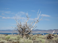
Yesterday's destination was Lee Vining (airport), the small town on the far side of Yosemite National Park and Tioga Pass and next to Mono Lake (Wikipedia).
While I don't yet have the good pictures (taken with a Digital Rebel XT), I do have those from my Cannon SD500. Here's a quick sampling of the sights.
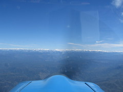
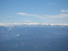
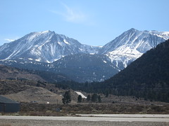
Approaching the Sierras
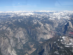
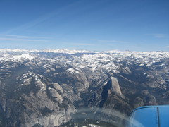
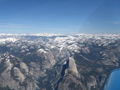
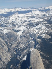
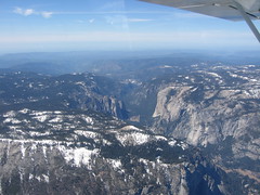
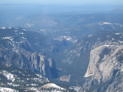
Yosemite Valley and Half Dome
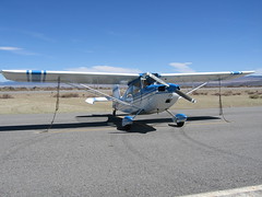
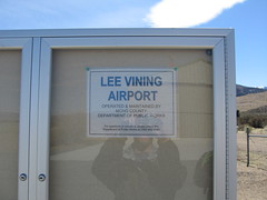
Lee Vining Airport
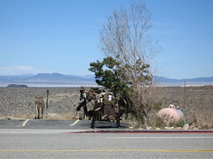
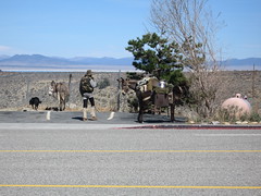
The "Mule Guy" in Town
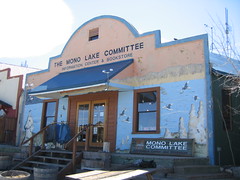
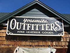
Various Sights in Town
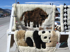
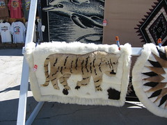
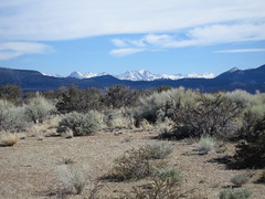
Various Ground Shots
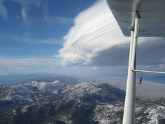
Lenticular (Wave) Clouds Over the Carson Valley
I'll post links to some of the much better shots when I get copies--including aerial shots of the lake itself (I was a little busy flying to take any), Placerville Airport (fuel stop), and the sunset on the way back to the Bay Area.
As you might expect, the full set of my pics are in the Mono Lake Trip set on Flickr.
Posted by jzawodn at April 01, 2007 07:12 AM | edit
Nice!
I did my first solo last weekend and did some simulated short/soft field landings yesterday. I remember your experience with those and can now understand the situation. I still have to do those on an actual short/soft field and I am sure that would be another interesting experience.
BTW, how do you record GPS tracks of your flights? I got some good data samples put on Google Earth in 3d (including the altitude data) - http://vsharma.net/downloads/flight_training/gps/
what altitude did you have to climb to to clear Yosemite?
I have always wanted to make that trip but never got around to planning for it - i am also not sure if there is place to eat once you get there - you know for that $200 burger
There's not a lot of food out there this time of year. But during the summer, it'd be a short walk into town for BBQ or whatnot.
Altitudes... We peaked at 14,000 briefly, but spent probably 20 minutes in the 13,000 range.
So funny, I saw "the mule guy" in Independence on the way back from Mammoth in February. He was telling us he just got back in the country after being run out of Mexico where he was hiding out from "the law". He had to go there in the first place because of a "unreasonable" US justice system. LOL! Anyway, good to see others taking pics of him, too.
http://www.flickr.com/photos/scottishlasagna/448545928/
BTW, I'm a friend of Marc Levin's. He pointed me to your site. - Craig
A clever one you are. I hadn't thought to refer to him as the Ass Man. Nice. :-)
How did you make it up to 14k feet when the service ceiling of your airplane is 11,500?
I don't believe the service ceiling is that low. I don't have the manual handy right now, but I'm pretty sure it's it the 17,000 foot range.